Mt. Baker Places Hike Twin Lakes Road, WA
Yellow Aster Butte
Summer–fall; October color
Tarns, October color, and 2,550 feet of climbing at the end of a gravel road
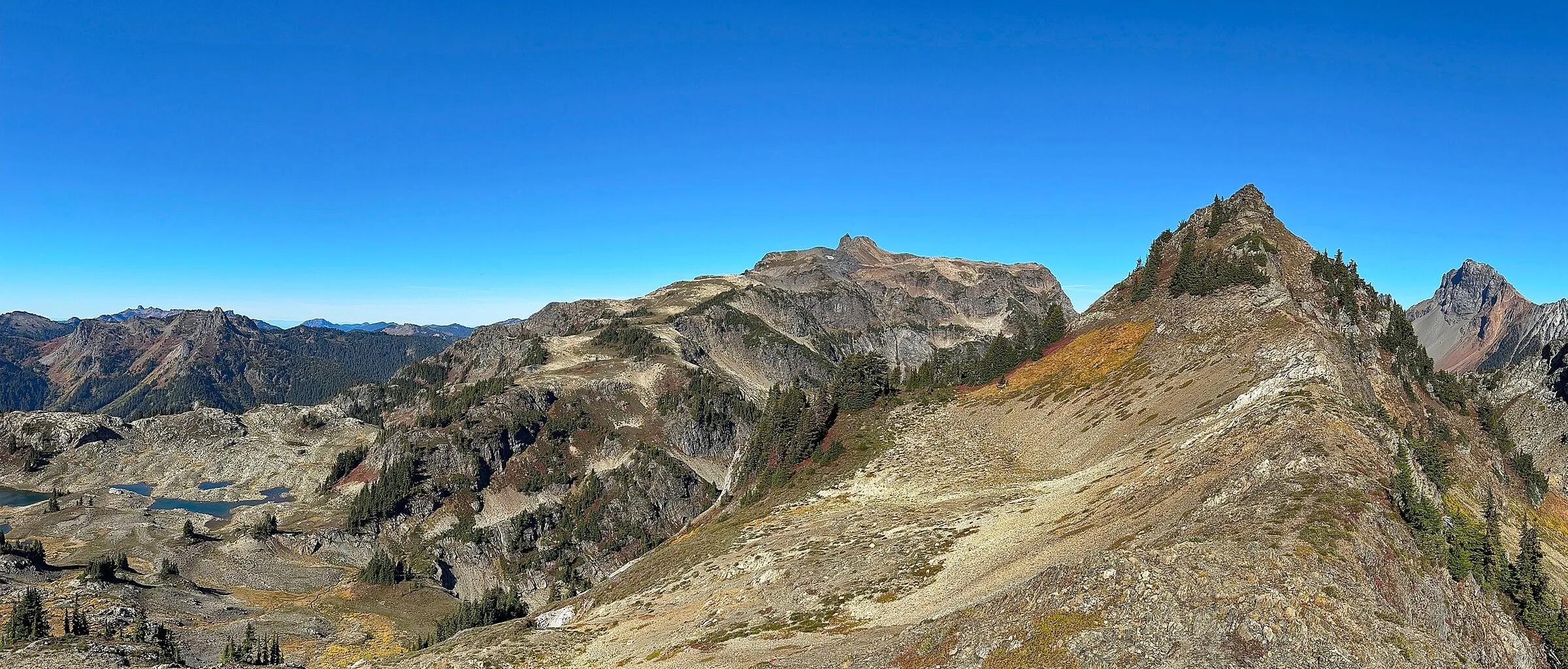
Yellow Aster Butte is the corridor’s fall-color hike and a genuine workout: 7.5 miles round trip, 2,550 feet of gain, topping out at 6,150 feet among the tarns. In October it carries a scattering of high-country gold and huckleberry red until the first heavy snow — the closest thing this valley has to larch season. For real larch stands you’re driving Highway 20; don’t let Pinterest tell you otherwise.
The approach is part of the commitment: 4.5 miles of gravel up Twin Lakes Road (FR 3065) before you park. This is strictly a snow-free-season hike — the route crosses an avalanche path — and the Forest Service has special rules here: pack out human waste rather than burying it, and camp only at or beyond the tarns, four miles in. The corridor’s wildflower peak hits early August; the full calendar is in our best hikes near Mt. Baker guide, and our Yellow Aster Butte trail guide covers the gravel road, the roadside-only parking and the camping and mountain-goat rules in full.
Know before you go
- Round trip: 7.5 miles
- Elevation gain: 2,550 feet; high point 6,150 feet
- Trailhead: Twin Lakes Road (FR 3065), 4.5 miles of gravel off SR 542
- Northwest Forest Pass ($5 day / $30 annual) or America the Beautiful pass required
- Not a snow-season hike; crosses an avalanche path; pack out human waste; camp at or beyond the tarns
- The Stage 1 forest-wide fire restrictions from July 2026 were rescinded effective September 15, 2026 — campfires are legal again on forest land; check current status before you go
Nearby & similar
More like this: all Mt. Baker Places · where to eat near Mt. Baker · the 9 best hikes